It has actually been drizzling rain for a few hours today as well, but the ground has just soaked it up as if it had never fallen. We found the "big old mango trees" referred to in the guide book... "virtually all that remains of the settlement that was once here. Except in a very dry season, waterholes in Dora Creek will permit travellers to camp here." A very dry season, huh? So the green slime hollows must have been the "permanent water" in the Mitchell River.
So my options: backtrack 15 km to the puddles, or forge ahead through potentially tricky country for 15 km to the East Hodgkinson River - which, after studying the maps, I reckon is 98% certain of having water. The big unknown. Hopefully it'll drizzle tonight as well and wet the grass for Nugget and Sarah. This may go down as a very bad decision for me, but then again.. ..I think we'll press on tomorrow.
Roman Creek
Monday
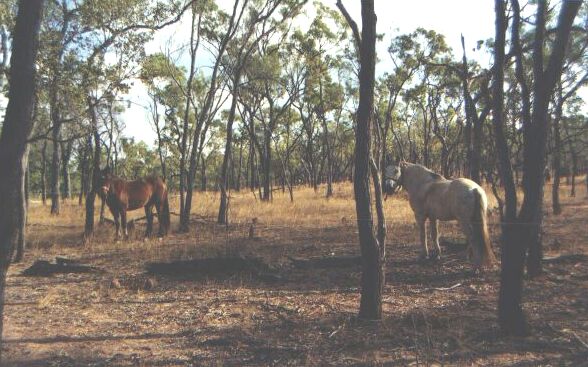
What a day! This can't keep up. It drizzled fairly steadily all night last night, so out of character for this time of year, but much appreciated since at least I knew Nugget and Sarah were getting some moisture from the kangaroo grass they were munching on. It's not very nutritious stuff, but at least it fills their stomachs - unlike what they've got to pick at tonight.
I was very concerned, though, to see a sore on Sarah's wither - despite the applications of insect repellent, her Queensland Itch is slowly spreading - this being very detrimental if it reaches her back since she will no longer be able to be saddled.
But the rain had balanced my decision - I knew there'd be puddles of water in the rocky gullies beneath the granite range, so on we plodded without either maps or a proper compass, yet amazingly finding the occasional trail marker nailed to a tree.
Trail marker
I was guesstimating our bearings by our position in relation to the granite range (running NE-SW) and other features on the sketch map, as well as the sun. There was water in the rocky hollows, much to the horses' joy, and I fed them the rest of the pellet feed I was carrying, mainly because it was starting to get damp from all this rain, and I didn't want them getting colic further down the track.
We continued up the old wagon road - still evident after 110 years of neglect - even the stone pitching in some sections remaining in perfect condition. At other places it was indistinguishable from the hundreds of cattle and brumby tracks going in every direction, so it was comforting to glimpse the occasional trail marker.
Several times I went right off track, and had to navigate by instinct until it became clearer. Once, after a couple of hours of bush-bashing through the most scary country - dry as a bone and littered with cavernous gullies making it impossible to ride in a straight line, we miraculously joined a southerly brumby path which turned out to be the trail.
We never lost it again - at one stage after crossing a sandy creek bed the directions were to bear 1 500 up to a gate in the fence - I didn't even bother taking out the piddly little compass I had left, just guessed the direction.. .and some time later, Bang! Hit the gate spot on! I was on a real high now, only a couple of kms to go down to the river where we could all have a well-earned rest day and try to get Sarah's back fixed.
As we got closer I had a very bad feeling.. .the ground was totally bare and very, very dry. Sure enough, the East Hodgkinson river with its expected "expanses of white sand and cool waterholes" was totally dry. Even the horses looked devastated. There wasn't even a blade of grass to offer them if we did stop.
The drought
I had a few options.. .Head back for the water at the base of the granite range - eventually going all the way back to Mt Molloy; try for a dam a few kms away (although I was certain that would be dry) then east to Mareeba; or try Roman Creek's "permanent waterhole' (I'd heard that before!) to continue on the trail.